Sunday, January 24, 2021

BBNP part 3

 1.24.21

                                   Friday’s hike to Cattails Falls, photos as promised


                                            The Tie down tree, and one of Nancy's favorite spots 


                                                          Cattails Falls Trail


                                                           Cattails Falls Entrance


                                                                 Cattails Falls


                                                        Tufts Canyon Overlook


                                                                Tufts Canyon


Saturday, I hiked into Burro Mesa Pour Off ( 2 miles RT) and Burro Mesa Spring, (4.8 RT). The Pour Off trail probably is one of the best 1 mile hikes I done. I had it all to myself until I was just about back to the truck, when I ran into a couple from Bow, NH, go figure. We chatted and then moved on. 


                                                         Burro Mesa Pour Off Trail


                                                     Burro Mesa Pour Off Entrance


                                                           Burro Mesa Pour Off


                                                   Looking Up Burro Mesa Pour Off


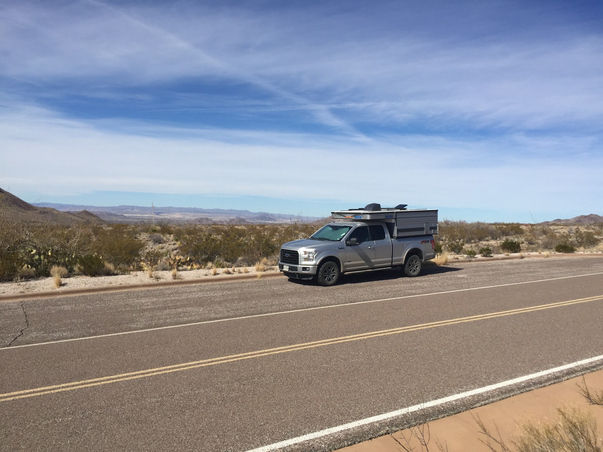
I love the “miles to empty feature” on the F150, since I only get 14 MPG and the closest gas station is in Panther Junction, 35 miles from Cottonwood Campground, it’s reassuring to see that I had 122 miles remaining as I made the turn from Burro Mesa and headed back to the campground. I don’t need another vehicle incident on this trip.


This is where I had a full rack of Verizon bars and posted my previous blog post


Saturday night was my last night at Cottonwood and I was rewarded with a pretty spectacular sunset.


I moved to Chisos Basin today, and have great cell coverage, so I'll post my Chisos adventure tomorrow.


tight lines and Travel Safe 


Saturday, January 23, 2021

BBNP Part 2


Alls well that ends well. 


The wrecker dropped the truck at the Ford dealer, in Ft. Stockton, Wednesday, at 12:45pm, and then at 5:15pm I was headed south back to Big Bend National Park. As I suspected it was the engine temperature sensor, a $26 part. Diagnosis, labor and parts came to $101. I was very thankful and grateful that they were not only able to get the truck into the service bay on the same day, but that they had the part in stock. It was 161 miles, and 3 hours back to Cottonwood Campground and I arrived at 8:15 pm. Poured myself a bourbon, cooked a couple of pan fried burritos and my little world was back to normal. 


Thursday morning, I woke to a gentle desert rain, and a fairly deserted campground. The empty sites all had tags which were valid until 1/22, but I guess the rain drove people out. I actually enjoy the rare desert rain. The desert takes on a sweet smell, and animals seem to become more active. I heard coyotes, an owl, numerous woodpeckers and even saw a lone white horse. I decided that I had enough driving on Wednesday, so after the rain stopped I drove the 8 miles to Santa Elena Canyon. It was an absolute mud hole, so I took it as an omen that today was going to be a day of relaxation and drove back to camp.


Friday, was a beautiful day, full sun which warmed the desert to the low 70s. I drove about 25 miles to the trailhead for Oak Spring. The gravel road was blocked about 500 yards in, so hiking the rest of the road added about 1.25 miles each way, but I was the only person. I hiked to the tie down tree, spread a little bit of Nancy, we had been here years ago, then continued to Cattail Falls, which is sort of a hidden little hike and one of the water sources for the park. I hung out at the falls for a while and then headed back. After 1o minutes I began to meet others hiking in. Total distance 4.5 miles. On the drive back to camp, I did the short 3/4 mile hike into Tuff Canyon and then continue through the slot canyon until I reach a short cliff blocking further progress, at least without someone else to spot me. Back to camp for a beer, steak, salad and leftover fried rice. A perfect day!


Just a reminder, there is very limited cell coverage and wifi exists at 3 spots in the park, nothing at Cottonwood Campground. I really appreciate the texts, emails, and comments, but I can’t respond in a timely manner. I have been writing my blog offline, then posting when I get a connection.


I’m sitting in a pull off near the mule ears, about ten miles from the campground, after hiking around the Burro Mesa area. I saw that I had a cell signal so stopped. No photos this time, I’m moving to the Chisos Basin on Sunday, and should have wifi and cell coverage there, maybe. Fingers crossed.

Wednesday, January 20, 2021

BBNP part 1 The Universe laughs

 Saturday, 1/16/21, The temperatures at the Ranch have recently been in the low 20s, so I decided to fill Enzo’s water in the morning, also because my motorhome furnace is over 16 years old, has never needed any repairs, I decided to play it safe and winterize the Moho. I  set the furnace at 45 degrees, had an early lunch, brought in the slides and hit the road just after noon. I made a quick stop at the grocery store to pick up some fresh produce. I planned a very short driving day, so I spent the night at Sunset Reef Campground, which is a free campground just south of Whites City, NM. The campground was previously a drill site. Rather than rehabilitate it back to the original desert, a number of private companies and government agencies joined forces to create an eleven site campground, complete with a SST pit toilet and covered picnic tables. I hope this idea gains traction and more abandoned drill sites end up like this. 


Sunday, I hit the road at 6am, and drove through oil country. This part of the permian basin is oil and gas mecca. Both sides of the road were dotted with drill rigs, pump jacks, storage tanks, processing plants, pumping stations, pipe lines and man camps. Travel was slow due to the numerous road construction one lane road closures. As I headed further south, the road construction ceased, the evidence of petroleum exploration decreased, creosote bushes began to dominate the landscape and the mountains of west Texas came into view. 


There is something that is relaxing about the desert mountains of West Texas. The roads run through the flat basins, and one can see for miles, since Creosote bushes only grow to 3-4 feet in height there is nothing to block your view.


I past through the North entrance station of Big Bend National Park around 1pm, and reached Cottonwood Campground around 2:15pm. The park road to the campground circles around the southern side of the Chisos Mountains and offers some incredible views of the high peaks, as well as panoramic views further west and south. The Big Bend National Park is mostly undeveloped, with only a few paved roads. Its vast expanse, larger than the state of Rhode Island, can’t be appreciated unless you spend a week or more here.


                                                         The Mule Ears

                                                Cottonwood Campground


I settled into my nice level site, with unshaded, southern exposure, a picnic table, large metal bear box, of course here it’s really a Javelina box. The reservation site listed Cottonwood Campground as a dry camp, so I was very surprised to see non-potable water faucets space along the campground road as well as a free reverse osmosis water fill station in the campground. 


                                         The Rio Grande River with Mexico on the left


The campground is on the banks on the Rio Grande River. The river is only about 30 feet wide and a couple of feet deep. Mexico is literally a stone’s throw from the campground, no fence, not even a sign, just wilderness.


Monday I headed out after breakfast to hike the Chimneys Trail. It’s basically just an easy walk thought the desert. The trail head is only about 12 miles from camp and after driving 312 miles the previous day, I thought it would be nice not to spend much time driving.


About 2.4 miles from the trail head, the trail reaches the Chimneys, rock pillars which rise from the flat landscape. There are some petroglyphs and ancient rock shelters hidden among them. It only took me an hour to reach the Chimneys, so I decided to continue on the trail for another mile, before having lunch and turning around.


It was only 2 o’clock when I got back to the truck, so I thought I might stop at one of the roadside exhibits on the way back to camp and go for a short desert stroll. The Universe had other plans for me. After a few miles of driving the “Coolant High Temperature” message and icon appeared on my dashboard and the truck went in to “safe driving mode”. I pulled over, check the coolant level, which was fine, read the manual and followed the instructions. Which said to let it idle for a few minutes, if it doesn’t cool down, shut off the engine and let it cool. An hour later, when I started the engine the message was there and the engine was still in safe mode. It said I could drive a short distance. I was four miles from the campground so off I went. I limped along at 10 MPH and made it to camp. 


The next morning, Tuesday, after it sat all night in 50 degree temperatures, and was cold to the touch, the message was still there and the engine was still in safe mode. There is zero cell phone coverage in the campground, no pay phones, but lucky for me the campground host had installed a hard phone line at her site. She let me use her phone to call roadside assistance. I spent an hour on the phone with an agent. She could find Cottonwood Campground on her map program, but her system would not allow here to input it as a location, then the call dropped. By then the host provided me a list of Ford dealers and Wreckers. The nearest Ford dealer is Fort Stockton, TX, 150 miles. 3 hours and $1025 tow away. I scheduled a wrecker to arrive between 9 and 10 am today, Wednesday 1/20/21.  


So here I sit, drinking coffee and waiting for the wrecker, I’ll post this when I get to the Dealer. In the mean time, I’m very grateful for Karen the Campground host, her phone, and the fact that I was able to limp back to camp at 10 mph, rather than be stuck on the side of the road. I’m also extremely grateful, that I wasn’t in a backcountry campsite in Big Bend Ranch State Park, 30 miles from a paved road. It could have been much worse.


More as it happens, stay tuned.

Monday, January 11, 2021

Solo Safety in the back country

 In a previous post I spoke about learning to travel in my motorhome alone and how I needed to do a little more planning as to overnight stops. Gone are the days that I can have my co-pilot look for an overnight stop an hour or so before I want to stop.

In a similar vain, I needed to examine the amount of solo hiking and fishing I do and what steps I can take to minimize risks. I have been thinking about this for a while. A couple of incidents in the last 8 months have made me aware that I need to do something. During the summer when I was fly fishing with Sonia up on the Grand Mesa, I walked across what I though was a little mud. It turned out to be quick mud and within minutes I was stuck up to mid thigh with both legs. Luckily Sonia and a fly fisherman were able to toss me various logs and about 45 minutes later I was able to get unstuck. Sonia had a Spot X, a satellite messenger device, which we didn’t need but would have been useful had I not been able to get out. But since there were two of us, she could have just driven my truck for help. 


But if I was fishing alone, it might have been a long cold night if another fisher person wasn’t nearby.


During one of my recent solo hikes in the Lincoln National Forest, I came upon a family of Javelinas, that day I had not seen another person the entire time I was hiking. The Javelinas were a good distance away and ran away from me. It did get me thinking that had I come across them suddenly and much closer, dad Javelina, may not have been very happy and my understanding is that they can be dangerous.


Yes, there is a school of thought that says I shouldn’t do this stuff alone, but that isn’t a reality for me, if I want to do the things I enjoy. I always carry my cellphone, since it is also my camera, but I don’t always have cell coverage. 


I have been weighing the pros and cons of various satellite messenger devices vs Personal Locator Beacons, (PLB). I finally settled on a PLB, there is no subscription fee and they all use the COSPAS/SARSAT satellite system rather than a private propriety satellite system.


In preparation fro my upcoming Big Bend trip I purchased a ACR ResQlink 400 PLB. Basically it is a backcountry SOS device for any life threatening emergency when you don’t have cell phone service. You deploy a very small antenna, which covers the emergency activation button, then press and hold the activation button for 2 seconds. It will then send your GPS coordinates and an emergency beacon for 24 hours via the COSPAS/SARSAT satellite system to NOAA, which then contacts the local search and rescue. It also has an infrared strobe light to help SAR locate you. 


                                                 The PLB is pretty small


Additionally, I wear MedicAlert dog tag and subscribe to their service. The dog tag has a toll free number and my ID number. Emergency personnel can call the number and speak with someone who has access to my medical information if I am unconscious. The demographic and medical information is easily updated by me online.


Of course, a rescue in the backcountry is not like dialing 911 at home, so I might have to hang around a long time and therefore always have extra clothing layers and an emergency survival shelter in my pack as well as the other essentials. Worse case scenario, SAR would know what to do with the body if the rescue turned into a recovery. That's for my good buddy Scott, since I know he's thinking it about now. 


I would encourage anywhere that ventures into the back country alone to consider a PLB or a satellite messenger device. 


I am leaving Saturday to begin my next road trip. I’ll spend 2 weeks in Big Bend National Park and 8 days in Big Bend Ranch State park. I will have very limited cell service if any, and there are only three locations with WiFi in BBNP. BBNP is larger than the state of RI, so I won’t be passing by the WiFi spots very often. But I may do an blog update while I’m there.


Tight lines and safe travels


Sunday, January 3, 2021

January 3 2021- a quick trip to the local mountains

 HAPPY NEW YEAR, let’s get 2020 and Covid in the rear view mirror. My deltoid is ready anytime they want to give me the vaccine. 


I had planned to go hiking and camping New Year’s eve, but mother nature had other plans. It was just a bit to cold, 19 degrees for a low, so I settled in at home. But yesterday it was sunny, the high was forecast to be in the 50s and lows in the 30s, so I headed out to Lincoln National Forest to explore a Forest Road and campsite I discovered when hiking a week ago. It’s pretty amazing what you can do with Google Map. I knew the road dead ended above Sitting Bull Springs Recreation area, but didn’t know where it began, but it didn’t take long to find it with Google Map. Turned out that Forest Road 525 begins just west of Queen, NM and winds 5.3 miles to the campsite. The road wasn’t bad just a rough high clearance rocky dirt road. On the way, I got waved down by two guys in a pickup coming out. They were bow hunting for Mule Deer and needed air in a rear tire. I used my compressor to inflate their tire, we exchanged a few pleasantries at social distance, bumped fists and parted ways. They had seen a couple of bucks, but couldn’t take a shot.


The campsite is totally exposed and the wind was blowing steady at 30 mph with higher gusts. 


I almost wimped out and left. Instead I decided to hike to the overlook and then play it by ear. 


The hike was great, although I had a full on head wind hiking back to camp. On the way back I met two more bow hunters. They were hunting those sheep I previously mentioned, but hadn’t seen any.


Doing the hike convinced me to stay and accept the wind, which by the way rocked the truck and camper all night long. Mother nature disappointed me at night when the clouds rolled in, so no star gazing. 


But in the morning, Mother Nature did reward me with a beautiful sunrise in the East and pretty bright moon in the west, plus the wind had calmed a little.


                                                      Sunrise view to the west


                                                                    The Road Out


Not much else to say, had breakfast, drove to the bottom of the canyon then did a short hike and headed home. 


                 View from the bottom looking up at the Mesa where I was camped


Tonight my birthday dinner is lamb chops on the grill!!!!! 


Tight lines and safe travels 


Hop you enjoyed the photos.

Sunday, December 13, 2020

Nancy's birthday

 Friday was Nancy’s birthday, she would have been 66. I decided I needed to do something outdoors to celebrate, rather than sit home and be sad. So since Enzo is always ready to go, I grabbed my hiking boots, day pack and headed out to Lincoln National Forest and specifically Sitting Bull Falls Recreation Area. I’m fortunate that it’s approximately 40 miles from my lease lot (aka home). I decided I’d hike the Last Chance Canyon Trail, and if I found a desolate off road campsite nearby, then I’d spend the night.


The hike was perfect, a short uphill climb over a knoll and then a relatively flat desert hike through Last Chance Canyon. It’s not a loop, so I decided I’d hike 3 or so miles in and then turn around. Along the way I met two hunters, they were hunting Barbera Sheep. I was glad I had my salmon colored sun shirt on and that I had trimmed my facial hair. You may have to google Babera sheep to get the joke.


                                              Last Chance Canyon Trail


After the hike, I left the parking lot and headed up Forest Service Road 227. It was a pretty rough, rocky 4WD road, which at times required 4WL and some caution navigating some extreme sections. The F150 performed flawlessly and after 0.9 mile, I topped out on a high desert knoll with a 360 degree view and a large flat “campsite”. After parking, popping the roof, I settled in with a bourbon on the rocks and was very grateful for the ability to “escape” into the wilderness and be surrounded by nothing. I could see forever and except for the barb wired fence next to the road and my truck, there wasn’t a man made object in sight.


Just after sunset, a severe wind advisory popped up on my phone, just about the same time as the wind at my campsite began howling. Yes, I had cell coverage in the middle of nowhere. Wind speed was forecast to be 25-30 mph with more severe gusts, so I settled into Enzo and cooked a simple one pot meal indoors. It remained cloudy and the wind rocked Enzo all night long, later the temperature dropped into the mid 30s, but I was very comfortable tucked away in Enzo. I had hoped to star gaze and sit under the milky way, but mother nature did not cooperate, maybe next time. This morning the wind continued violently, so I nixed any plans to hike, packed up and drove home.


                                              Morning and the road out.


In case I don't post for awhile, Happy Holidays, Merry Christmas and Happy New Year.


Be safe


Wednesday, December 2, 2020

Learning to make camping arrangements in the Covid World


I had a great time traveling and camping in Enzo on my last trip. I also wanted to get to the Big Bend area of Texas this winter. Big Bend Ranch State Park in February 2018 was our last real camping trip before Nancy was told she had MDS. 


The Big Bend area as well as so many other wilderness areas have become very popular during the pandemic, combine that with limited campsite availability and it’s a nightmare trying to get a campsite. 


Big Bend National Park is camping by reservation only. Normally, a large number of campsites are also available on a first come, first serve basis, not so now. To make matters worse, many of the first come, first serve sites were not put into the reservation system and remain unavailable.


I spent quite a few hours, on a couple of different days, online, as well as on the phone, but finally I was able to put together an itinerary combining both primitive campground sites and primitive backcountry drive-in sites, in both the national park and the state park beginning mid January.


I’m psyched. If the weather is nice in the Guadalupe Mts, then I start my trip there, then head to Big Bend National Park (BBNP). I have 7 nights at BBNP Cottonwood Campground in the desert along the Rio Grande, then 2 nights in the Chisos Basin, then 2 nights each at two drive-in backcountry sites. The different camping sites will put me within short drives of many of the best hikes in the park. It took 3 visits to the reservation website plus a phone call on two different days to make that all happen. Evidently, people are constantly canceling reservations and then they instantly become available. So its worth checking the website multiple times a day and then jumping on a available site. The site has a timer, which counts down and kicks you off after a certain amount of time.


Once I locked in my days at BBNP, I then looked at Big Bend Ranch State Park (BBRSP) and scored 3 different 4WD backcountry sites for a total of 6 nights in the interior of BBRSP and then another 2 nights in the river section of BBRSP. If the weather holds in the Guadalupe Mts, I’ll stop there before heading back to my motorhome at the Ranch in NM. All in all, I’m looking at about a month on the road in Enzo.


West Texas is leading the state of Texas in new Covid cases, but NM is pretty much leading the country. So I’ll bring food and supplies for the entire trip with me, as well as 3 months of meds, just to be safe. Then except for passing people socially distant on the hiking trails I won’t have any contact with another human, and hopefully no contact with any Javelinas as well. LOL.


In anticipation of the trip, I made a few modifications to Enzo. I added Polyisocyanurate rigid foam panels to cover the two glass windows in Enzo for those cold nights in the mountains and added another storage area for food. The wanderthewest.com forum was very helpful. The rigid foam panels are covered in foil on both sides but the edges are exposed. One suggestion on the forum was to wrap the edges with tape, which I did. I used black gorilla tape. The tape not only prevents pieces of foam from cracking off the edges, but looks good as well.


My two week quarantine ended on Sunday, so once this cold snap is done, I get out and do some hiking in the Lincoln National Park and Carlsbad National Park, both of which are in NM and therefore won’t require me to quarantine.


Tight lines and safe travels

Alaska, the final installment

  Saturday, 7/6/2024 My trip was winding down and after a nice morning with Michelle and her dad, I headed north back to Anchorage to visit...